No active alerts
Earthquakes & Tsunamis
Earthquakes

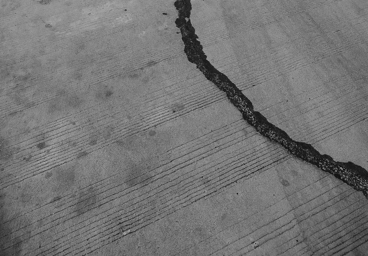
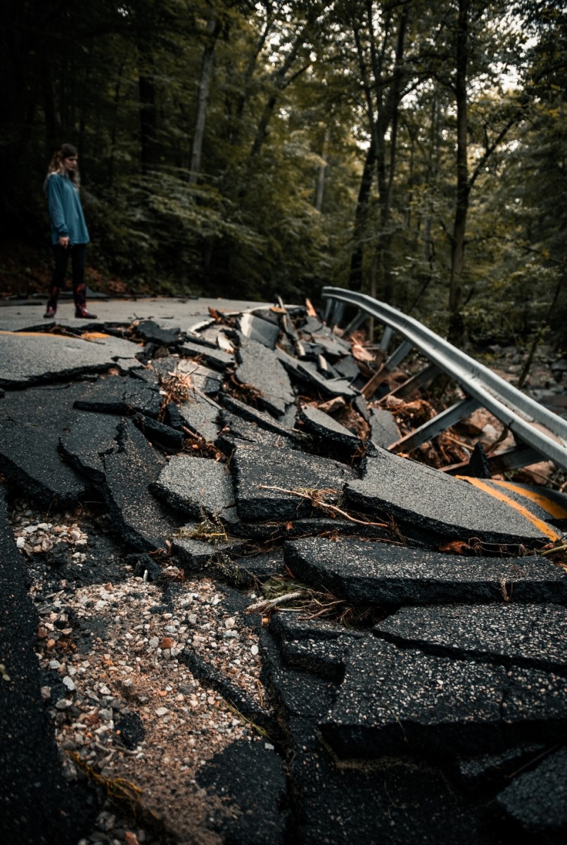
Earthquakes happen every day across the Pacific Ocean and West Coast of BC and the US. Major earthquakes are infrequent but invariably will occur. An earthquake is a sudden, violent shaking of the Earth’s crust, producing strong shaking that may last more than a minute or might make it difficult to stand. Areas with homes built on loose and sandy soil near the water may be at higher risk of liquefaction. Liquefaction occurs where the earth shakes so violently that loose soil near the ocean becomes saturated with water which could cause structures to collapse.

What To Do During An Earthquake
To protect yourself, always “Drop, Cover and Hold On” until the shaking stops, and then head to higher ground, inland or the upper story of a stable building immediately if you are in a tsunami hazard area.

Inside
  • Move to the closest safe place, under a table or door frame.
  • Drop to the ground.
  • Take cover and protect your head.
  • Hold on until the shaking stops.
Outside
  • When you feel the shaking begin, find a safe and clear space away from building, trees, powerlines, or any other overhead hazards.
  • Drop, cover, and hold until the shaking is over.
Driving
  • Pull over to a safe spot with no overhead hazards. Remain in the vehicle with you seat belt on until the shaking is over.
  • After the shaking, drive carefully to avoid debris and avoid bridges, off-ramps, and other road infrastructure that may have been damaged.
Tsunamis

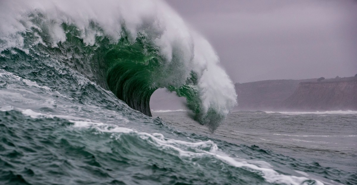
A tsunami consists of a series of waves that may last for up to twelve hours. A tsunami may not look like a big wave, but more like a rapid rise and fall in the ocean level. The first wave from a Cascadia Subduction Zone earthquake could arrive in the Tofino area in 20 minutes, and Greater Victoria in 75 minutes, but the largest wave may not arrive until later.

The eastern side of Cowichan region is at a lower risk during a tsunami event but low laying areas may still experience some impacts in the event of a major tsunami. The coastal areas on the western side of the Cowichan region including sections of the West Coast Trail could be in the tsunami inundation zone.

The National Tsunami Warning Centre identifies tsunami threats using deep water buoys, seismometers, and tide gauges. Any seismic activity large enough will trigger a warning that will be broadcast across Cowichan Alert, local media, and other emergency notification systems.

Type of Tsunami Alerts:

Tsunami Information Statement: An earthquake has occurred and there is no threat of a destructive tsunami

Tsunami Watch: There is a potential threat to an area, but communities have time to prepare.

Tsunami Advisory: The threat of tsunami has the potential to produce strong currents dangerous to those on, in or near the water. Coastal areas may be at risk due to strong currents.

Tsunami Warning: Imminent threat of a tsunami from a large undersea earthquake or a potentially destructive tsunami is underway. An evacuation of low-lying coastal areas may be ordered.

How to Prepare:
  • Know the Risk. Make a Plan. Build a Kit.
  • Know your local area and locate any Tsunami Hazard Zone exit near you.
  • When living in or visiting the coastline, plan your evacuation route in the event of a tsunami warning. This includes planning how you would get to higher ground.
  • In your home or work, secure all items that could fall during an earth quake and ensure heavy objects are stored in low shelving and cupboards.
  • Practice: Participate in the annual ‘Great ShakeOut’ to exercise your personal emergency plan for an earthquake or tsunami – Participate with your school or workplace in October every year. Join the drill
  • Sign up for CowichanAlert
What To Do In An Tsunami
If you feel shaking and are near a coastline, move to higher ground once shaking has ceased. During a tsunami watch, advisory or warning, it’s important to stay away from coastal and low-lying areas in the Cowichan region until local officials to tell you it is safe to return.
Current Burning Permissions
Open burning—or burning outdoors—is allowed when the wildfire risk is low and can be a useful tool when conducted responsibly. Open burning includes Category 1 campfire, Category 2 and Category 3 open fire.
CATEGORY 3
CATEGORY 2
CATERGORY 1 CAMPFIRE
FIRE BAN
CLOSE
Regional Water Use Restrictions
During drought conditions, your water system operator may introduce water use restrictions to conserve limited water supplies. There are four stages of water restrictions which are coordinated across the Cowichan Valley. Local conditions may sometimes require a higher stage of water restrictions on certain systems.
No Restrictions
Stage 1 Restrictions
Stage 2 Restrictions
Stage 3 Restrictions
Stage 4 Restrictions
CLOSE