
Overview
Deficiency of precipitation over an extended period, resulting in a water shortage.
- Linked to hazards – heat, wildfire, food source & water service interruption.
Characteristics
Type:Chronic
Duration:Months - Decades
Seasonality:Mainly Summer
Warning Time:Months - Years
Extents:Regional
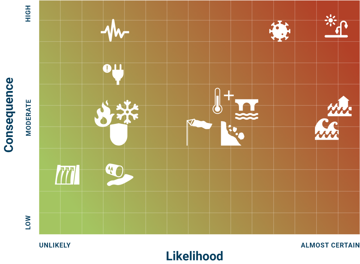
Likelihood:Almost Certain
Likelihood Trend:Increasing
Consequence:High
Comment:“New Normal"